Signup for our Newsletter
Receive our latest updates by signing up for our newsletter!
The innovative research being done by local academic institutions and nonprofits on the concerning effects of climate change on the North Shore will be presented at events on October 5 and 6.
In addition to research on the ecologically-essential Great Marsh, compelling aerial imagery will also give residents of Essex County coastal communities a look at the future as sea levels continue to rise.
The Marine Biological Laboratory in partnership with Greenbelt will celebrate the Great Marsh as a local treasure at a family-friendly event on Oct. 5.
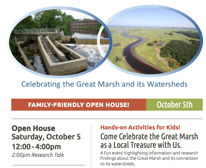 The important role of the Great Marsh and the threat brought by pollution and climate change have been the subject of MBL research. They will present their research findings about the Great Marsh and its connection to its watersheds, while hands-on, science-oriented activities will engage children.
MBL has been conducting research in the Plum Island estuary for almost 100 years.
The presentation and family activities will be held at the Marine Biological Laboratory, 297 Newbury Turnpike in Newbury, from noon – 4 p.m. on Saturday, October 5. The research presentation will be at 2 p.m.
As the effects of climate change grow, National Oceanic and Atmospheric Administration scientists predict a continued rise in sea levels. A warming world is also bringing the Essex County coast more intense storms with higher storm surges.
Just a one-foot rise in sea level would bring flooding – ranging from minor to severe – to every coastal community in Essex County.
 The sea would cover 4,500 acres in Newbury, 2,750 in Salisbury and 4,200 in Ipswich, according to pioneering mapping techniques developed by Salem State University professor Stephen Young. Scenarios showing three or five-foot rises in sea level would bring even more flooding to cities and towns along the coast.
Young’s exhibit, which will open to the public on Oct.6, will show how the use of satellite imagery and other data inform scientists studying climate change.
Visitors to the exhibit will see scenarios where now dry land will be under water, and imagery depicting the increasing impact of storm surge during extreme or catastrophic weather events.
This analysis also provides a visual tool for municipal planners to use when considering the siting of infrastructure, planning evacuation routes and taking steps toward improving climate-readiness and coastal resiliency.
The presentation and exhibit will be held at the Cox Reservation Studio Barn, 82 Eastern Avenue in Essex on Sunday, October 6. Refreshments will be served at 2 p.m., with a presentation by Dr. Young at 2:30 p.m., and the exhibit open to the public from 3 – 5 p.m.
The exhibit will remain open to the public weekdays until Oct. 18 between 9 a.m. and 5 p.m.

April 12, 2024

March 16, 2024


February 21, 2024