Donibristle Reservation
Hardwood Forest, Wide Trails & Spring Warblers
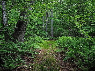
High on a ridge above the surrounding landscape, a canopy of pine, oak, and hickory offer a world of tranquility and beauty.
Please wait, map is loading.
Location, Directions & Parking
- Hill Street and Rowley Bridge Road, Topsfield (Opens in Google Maps)
Pull into the driveway and park on the side of the road.
With its easy access and parking, the Donibristle Reservation offers visitors a fantastic opportunity to hike along beautiful old woods roads now used as trails. The forest attracts wildlife such as white tailed deer and turkey, as well as warblers during spring migration.
Streams and wetlands support the Ipswich River watershed and old stone walls mark colonial-time field edges where dairy herds once grazed.
The property abuts the permanently protected open space of English Commons. Donibristle trails connect to its public walking trail, which is maintained by English Commons.
Indigenous people known as the Pawtucket had a village in Topsfield not far from this land at the junction of Fish Brook and Ipswich River. The original name of Topsfield, Shenewemedy, was an English corruption of an Algonquian place name referring to level ground, ideal siting for cornplanter villages.
The people would have used the natural resources found here and on surrounding lands. They also mined raw copper from Nichols Brook nearby, which they pounded into disks to wear as jewelry or body armor.
Donibristle was the original country farm estate of renowned historian James Duncan Phillips, who purchased the property in 1911. It is among the famed rural summer retreats that are part of Topsfield’s long history. With the development of better road access to the town in the late 1800s, wealthy Salem shipping magnates converted existing colonial farms into comfortable "country seats."
Phillips' wife, Nannie Borden Phillips, helped in the development of a model dairy farm with registered Guernseys, no doubt the result of her upbringing in the Borden family known for its milk products. His prize-winning draft horses were judged at the Topsfield Fair.
In 2017, a grassroots community effort led to the successful protection of the property. Greenbelt acquired Donibristle Reservation with the help of private donors, the Town of Topsfield, and the Commonwealth of Massachusetts through a Local Acquisitions for Natural Diversity (LAND) Grant. The property abuts the permanently protected open space at English Commons, and the Donibristle trails connect to the English Commons public walking trail.
The mixed hardwood forest of red oak, white oak, red maple, hickory and white pine complete a landscape that was once cleared as pasture for grazing. Wetlands scattered throughout the property reveal skunk cabbage and singing peepers each spring.
In springtime, the hardwood canopy teems with warblers and visitors may hear the bold gobbles of a male turkey. In colder months, hairy woodpeckers and brown creepers can be found searching for insects on tree trunks. Look for mammal tracks in mud patches.
Get GreenbeltGo Trails App
Land Acknowledgment
The properties that Greenbelt conserves are on the ancestral lands of the Pennacook and the Pawtucket, bands of Abenaki-speaking people. Join us in honoring the elders who lived here before, the Indigenous descendants today and the generations to come. Learn more…


