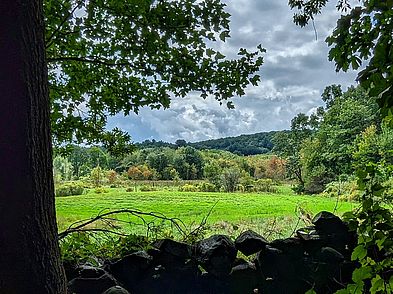
Farnsworth Reservation
Wooded Wetlands, Vernal Pools & Drumlins
Catch a glimpse of elusive wildlife within this classic New England mix of wooded upland and wetlands.
Please wait, map is loading.
Location, Directions & Parking
- South Bradford Street (Opens in Google Maps)
- Winter Street (Opens in Google Maps)
Park on the shoulder of the road at either location.
The North Andover landscape shows the unmistakable influence of continental glaciations. This is most notable in the presence of a number of oval-shaped hills or drumlins, as well as many irregularly shaped swamps and bogs resulting from disrupted drainage patterns.
In addition to classic glacial features to explore, Farnsworth Reservation also provides an important link between the North Andover Town Farm Forest and Harold Parker State Forest, creating a significant “greenbelt” with other protected land.
For a pleasant 1.3 mile trail loop, begin at South Bradford Street, cross the boardwalk and continue around the loop trail. Purgatory Swamp is a large red maple swamp and a haven for wildlife. Bruin Hill is a wooded upland with trails accessible from Winter Street.
The Farnsworth Reservation is in an intervale between Mosquito Brook and Fish Brook. The Pawtucket had a settlement near here at the junction of these brooks. They relied on the vital subsistence resources in Purgatory Swamp, which also served as a refuge in times of conflict.
On nearby Bruin Hill, they hunted wolves, bears, and cougars (which colonists called lions or catamounts). Bears were sacred to Algonquians and the bear was also the spirit animal or totem of certain kin groups. The Pawtucket ceremonial calendar included an annual winter bear sacrifice. During the 1600s, the General Court of the Massachusetts Bay Colony paid bounties on wolves to both Native people and the English, as wolves were preying on colonists’ cattle.
The Farnsworth Reservation is named for the land donor, Hebert Farnsworth, a pioneer in an industry that would revolutionize American eating habits by bringing cold storage technology to the seafood industry. His legacy is a family committed to land conservation and the protection of many landscapes across Essex County.
Trails lead through mixed hardwood and softwood stands of red oak and white pine, as you pass numerous vernal pools and cross through wooded wetland dominated by alders, red maple and skunk cabbage.
In spring, look for salamander and frog activity around the vernal pools. Deer are common and great horned owls may nest in the large white pines. In drier months, a vernal pool may appear as a depression in a wooded area.
Get GreenbeltGo Trails App
Land Acknowledgment
The properties that Greenbelt conserves are on the ancestral lands of the Pennacook and the Pawtucket, bands of Abenaki-speaking people. Join us in honoring the elders who lived here before, the Indigenous descendants today and the generations to come. Learn more…


