Bald Hill Conservation Area
Forests, Wetlands, Ponds & Vernal Pools
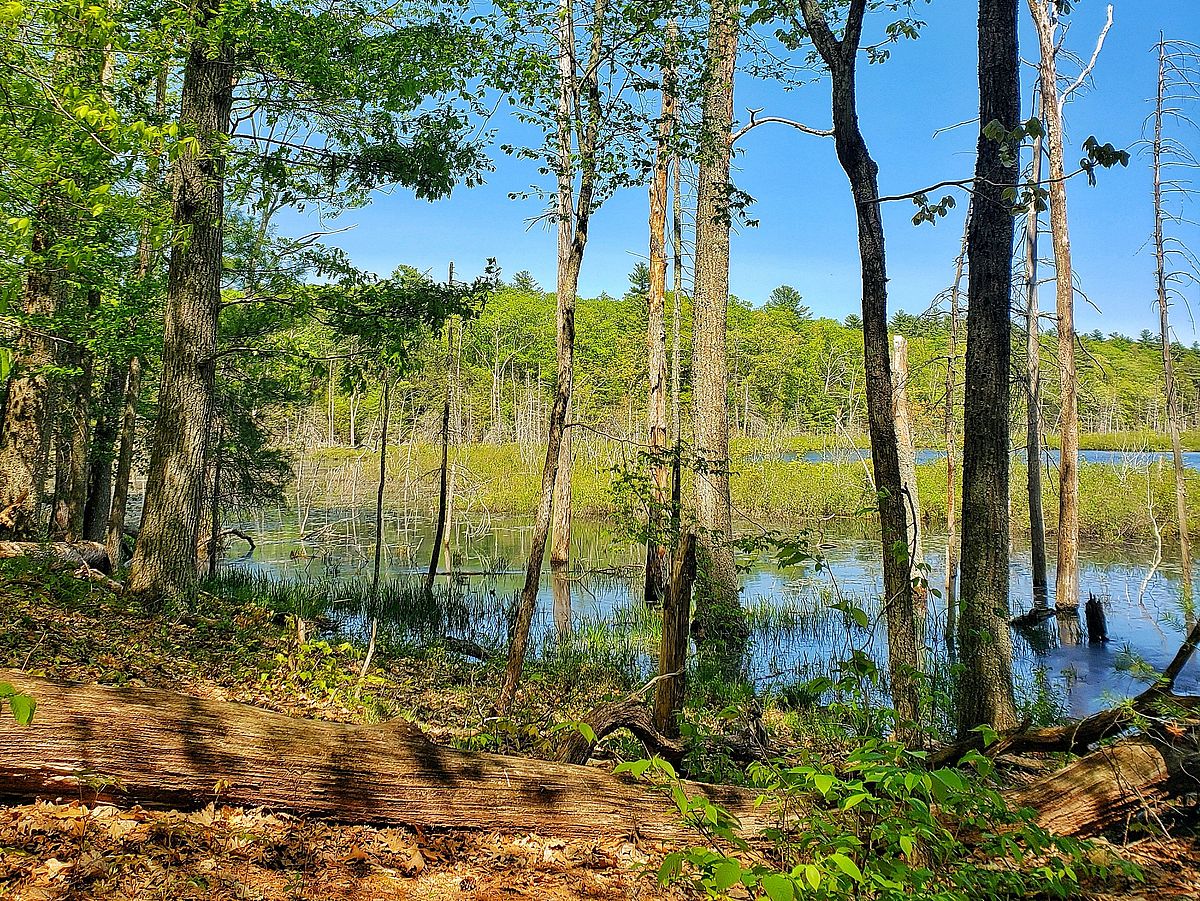
Bald Hill’s assemblage of rich forests, diverse wetlands, and open water supports an extraordinary diversity of plant and animal life. Greenbelt protects 25 land parcels within a much larger protected area.
Por favor, espere, el mapa se está cargando.
Location, Directions & Parking
- Middleton Road North (Opens in Google Maps)
- Middleton Road South (Opens in Google Maps)
- Sharpner’s Pond Road (Opens in Google Maps)
There is parking for several cars at each trail head.

Featuring 25 miles of easy-to-moderate terrain with connecting trails, a section of this route is part of the 230-mile Bay Circuit Trail, which spans Eastern Massachusetts from the Merrimack River’s mouth to Kingston Bay.
Towne Pond Trail
3.7 Mile Trail Loop | Easy to Moderate
Begin at the North Parking Area on Middleton Road. Hike on a wide, flat trail through a mature forest of pines, hemlocks and hardwoods. As the trail narrows, bear right at the first intersection and continue uphill as you enter Greenbelt’s Price Reservation. At the next big intersection, bear left and enjoy the view of Towne Pond on your right. The trail along the pond eventually passes over an earthen dam with a beaver deceiver and beaver lodge in sight. At the southern end of the pond bear left at trail intersection and return downhill through an open hardwood forest to the trail you started on. Bear right back to the parking area.
Crooked Pond Trail
1.9 Mile Trail Loop | Moderate
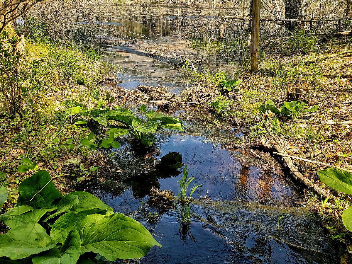
Begin at the South Parking Area on Middleton Road. Hike on a wide trail through a mature woodland, passing a beautiful freshwater wetland on your left. Continue up the trail until Crooked Pond becomes visible with its many standing dead trees. With the pond on your left, the trail skirts the steep wooded hillside due to beaver flooding. Toward the western end of the pond bear left, and follow the trail across a small beaver dam where the trail is often flooded. Stay left at the first intersection, and remain on the main trail before going left again at the second major intersection. This trail takes you downhill back to a trail along the pond and eventually reconnects with the trail to the parking area.
Fuller Loop Trail
2.0 Mile Trail Loop | Easy
Begin at the Sharpner’s Pond Road parking area. Hike on a wide, gravelly woods road through a stand of young birch and poplar trees that leads to a beautiful old quarry. Either take trails to the left at the quarry or bear left earlier at the “Swimming” signs to continue on the loop trail. The trail eventually passes a large wooded wetland on your left that is an excellent birding and general wildlife observation area. Continue along the loop trail and generally bear right at intersections until you return back to the quarry.
Bald Hill East is adjacent to the Boxford State Forest and the John Phillips Wildlife Sanctuary, together consisting of 2,267 acres spread across Boxford, North Andover, and Middleton.
Bald Hill’s landscape has been shaped by use as a woodlot and pasture, as evidenced by some of the stone wall remnants. Today it holds rich forests, wetlands and ponds, with beavers busily creating more ponds.
Greenbelt delineated three trail loops to consider exploring while visiting this vast property. A small portion of the 230-mile Bay Circuit Trail meanders through this conservation area as well.
This land had spiritual significance to Indigenous people living in the area. They would have centered their calendrical observations and community rituals at Bald Hill, which retains evidence of a ceremonial stone landscape. The people also would have centered many of their subsistence activities at Crooked Pond with its beaver dams, bogs, Ph-neutral water, and limestone-nourished plants such as marsh dogwoods and marsh marigolds.
The people were Pawtucket, also called the Agawam. Approximately 200 Agawam were living at Bald Hill at the time of English settlement. They were not a tribe but an alliance of bands with villages in northern Essex and northern Middlesex counties, all under the aegis of the Pennacook Confederacy of the Merrimack Valley, based in New Hampshire.
Visionary Greenbelt founders Jack Peirce, Henry Sawyer and Stephen Maddock came together to protect Bald Hill from development in 1961. Since then, Greenbelt and the Commonwealth of Massachusetts have protected nearly 2,000 acres in this area.
Spring finds salamanders breeding in its two dozen vernal pools, and the air alive with spring peepers singing. Crooked Pond and the slopes of Bald Hill are among the country’s best locations to see breeding birds and their courtship rituals in April and May. Winter wildlife tracking, perhaps by snowshoe or cross-country skis, is also an exciting adventure.
Get GreenbeltGo Trails App
Land Acknowledgment
The properties that Greenbelt conserves are on the ancestral lands of the Pennacook and the Pawtucket, bands of Abenaki-speaking people. Join us in honoring the elders who lived here before, the Indigenous descendants today and the generations to come. Learn more…